Xining Map
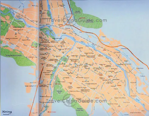
Xining is located in Huangshui Valley, the east of Qinghai Province. It is the eastern gateway to the Qinghai-Tibet Plateau, the terminal of the Lanzhou-Qinghai Railway and the beginning of the Qinghai-Tibet Railway and the Qinghai-Tibet Highway. Its land descends from north to south. The Northwest is higher than the Southeast. It is long and narrow from east to west, which looks like a raft. The Huangshui River and its branches Nanchuanhe and Beichuanhe converge in the downtown Xining and run across the city eastwards.
In this map of Xining City, you can find the major roads there, such as Qiyi Lu, Kunlun Zhonglu, Nandajie and Beidajie. The major shopping centers, hospitals, banks, schools and hotels are marked clearly. The tourist attractions are written in red. Also you can see some parks with high percentage of greenery coverage. Two railway stations can be found, including Xining North Station and Xining Station. The train from Xining to Lhasa starts from this station. About 2.19 kilometers from the Xining Railway Station, the city's Bus Station can be found. It costs around CNY7 from the railway station to the bus station by taxi.

